Kokkino Vouno:
a purlieu of the urban centre at Akrotiri
ΑNDREAS G. VLACHOPOULOS
Republication of the article "A. Vlachopoulos, "Kokkino Vouno (Red Mountain): a purlieu of the urban centre at Akrotiri, Thera", Als (Periodical Publication of the Society for the Promotion of Studies on Prehistoric Thera)
 8, 2011-2012 (2021), pp. 154-170".
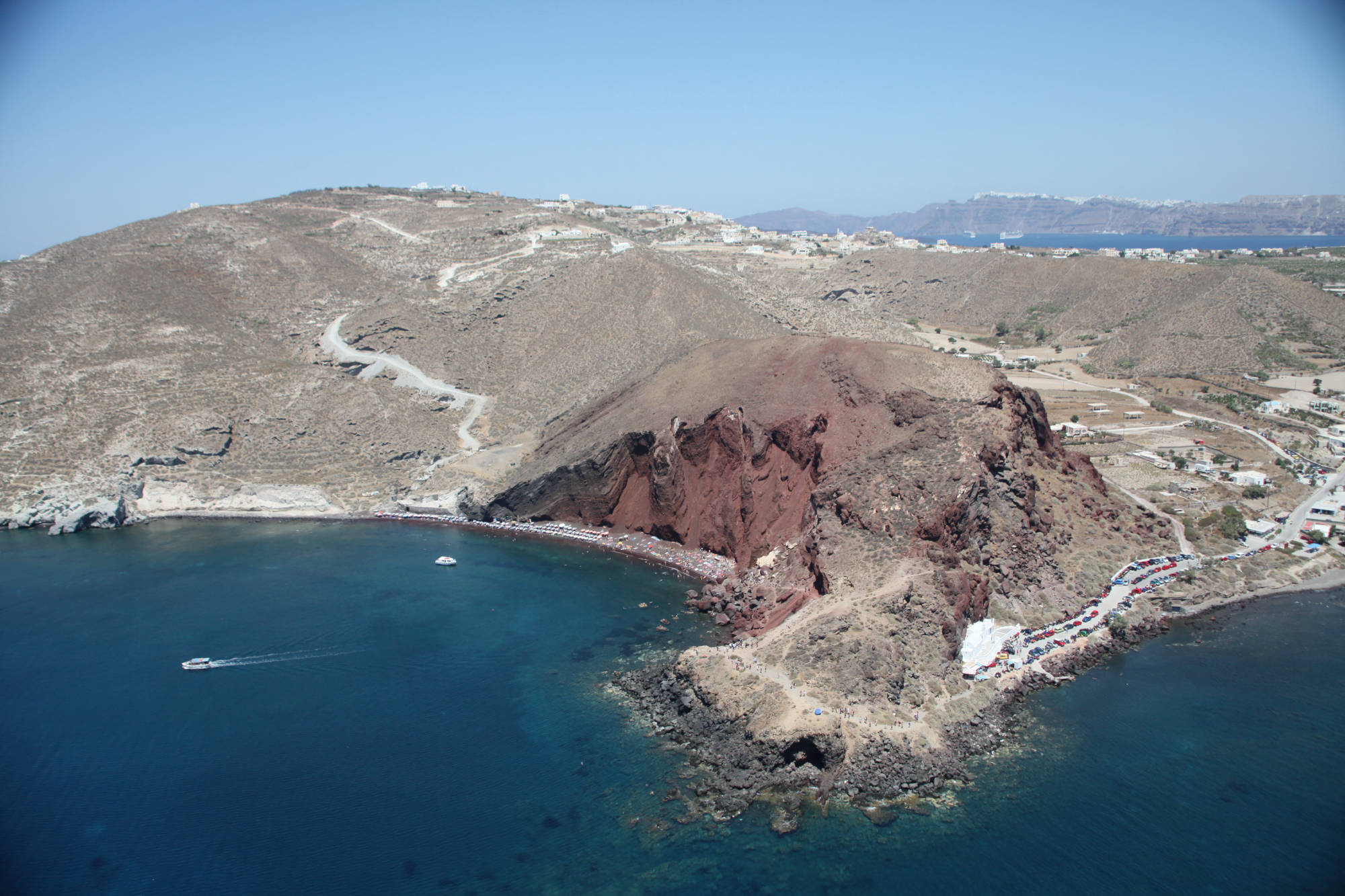
During the second season of the excavation at Akrotiri (1968), Spyridon Marinatos observed that above the chapel of St Nicolas, on the west shore of Akrotiri, and in other places around Loumarades hill, there are no deposits of volcanic ash and that the lava of the pre-eruption landscape of Thera is bare everywhere (fig. 1).He himself was unable to give an explanation for the absence of material from the eruption so close to the prehistoric settlement, and passed on the issue to the specialists, geologists and volcanologists, to investigate. He turned his attention to Kokkino Vouno (= Red Mountain) (fig. 2), the bluff above the chapel of St Nicolas (Ai Nikolaos) (fig. 3), where ‘extensive dense remains of walls, but poorly preserved … appeared after a small excavation’, lasting one day, as he notes.
The terse reference to this excavation in the Proceedings of the Archaeological Society (ΠΑE) of 1968, and in the excavation report of the same year (Thera ΙΙ) is filled out a little by Marinatos’s personal daybook, in which it is apparent that his desire to investigate the hill in the vicinity of Akrotiri was the outcome of mature and hopeful thinking about the undertaking. From the daybook we learn that research on the summit of Kokkino Vouno was carried out on Sunday 15 September 1968. The reference to a ‘new trench’ attests that another attempt to investigate the space had preceded.
The excavation on the topmost flat zone of Kokkino Vouno was clearly exploratory rather than scientific in nature. It yielded finds which, according to Marinatos, ‘demonstrate the affluence of the inhabitants’ – that is, ‘sherds of fine pottery, a fragment of metal and fragments of painted plaster’. Particularly interesting was a ‘fragment from the rim of a large vessel fashioned from lovely veined marble’, which is even sketched in his personal daybook. For the villagers of Akrotiri, the flat area on top of Kokkino Vouno (fig. 1) is a favourite place for hunting wild rabbits. However, until the 1970s it was cultivated by its owner, Tassos Arvanitis, another ‘historic’ figure of the first seasons of the excavation, due to his friendship with Marinatos from the time he was running the small taverna and subsequent hotel near the beach.
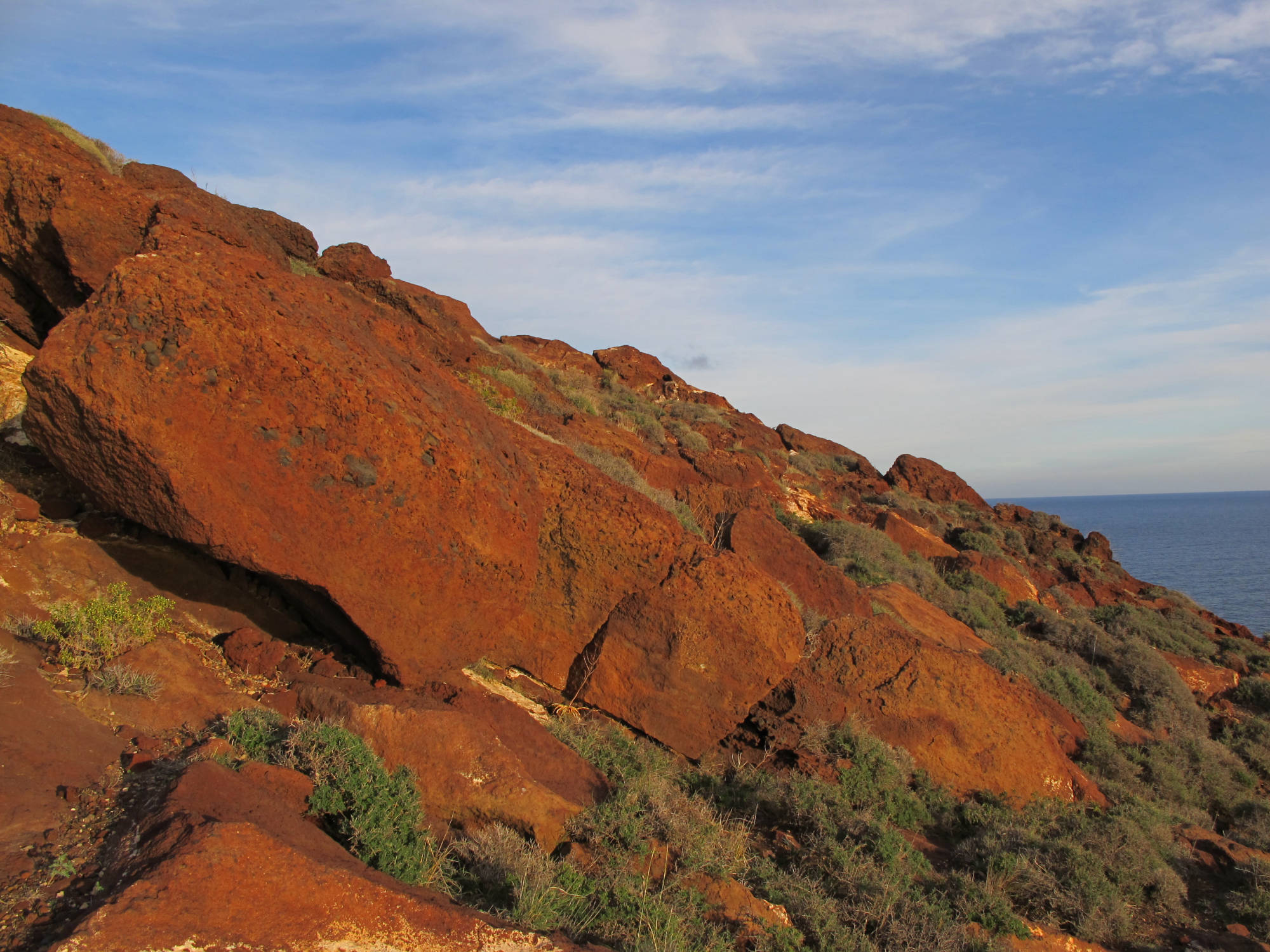
To climb up Kokkino Vouno, we either follow the same precipitous path as the local hunters, directly behind the chapel of St Nicolas, or take the gentler route on the north slope of the hill, on the col formed by black lava towards the Kokkini Paralia (= Red Beach). Whichever path we take, we come across scars from quarrying large blocks of red ignimbrite (fig. 4), source of a considerable volume of the building material for the prehistoric settlement.
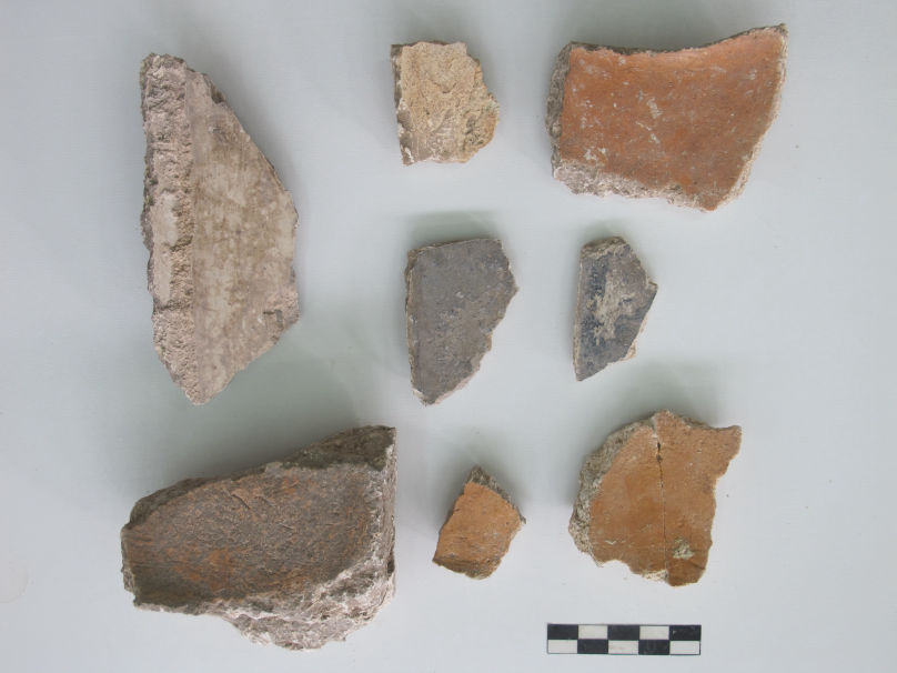
The trench opened by Marinatos is still visible on the uppermost terrace of Kokkino Vouno, running for a length of approximately 4 m but not very wide (due to the earth that has subsequently filled it) and of depth 0.80-1.00 m (fig. 5). On the sides of the trench, the concentration of pottery and, primarily, plaster fragments is still notable, indicating that the trench reached the horizon of a built space, as remains of walls were found all around.
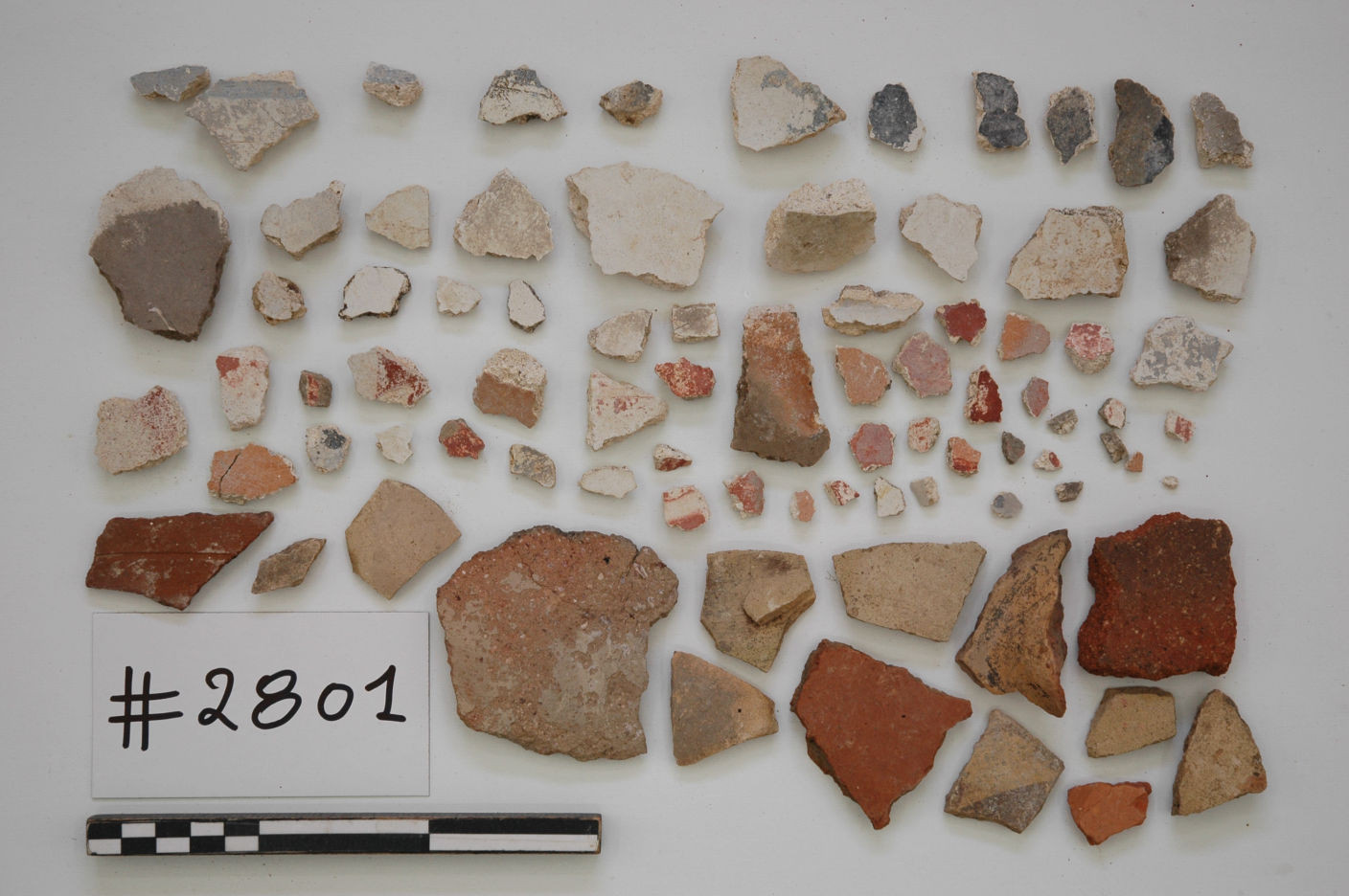
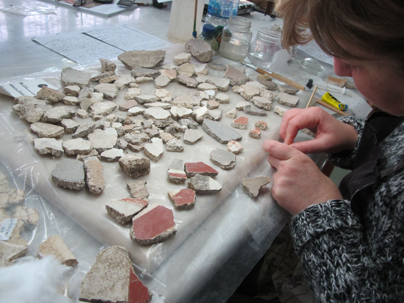
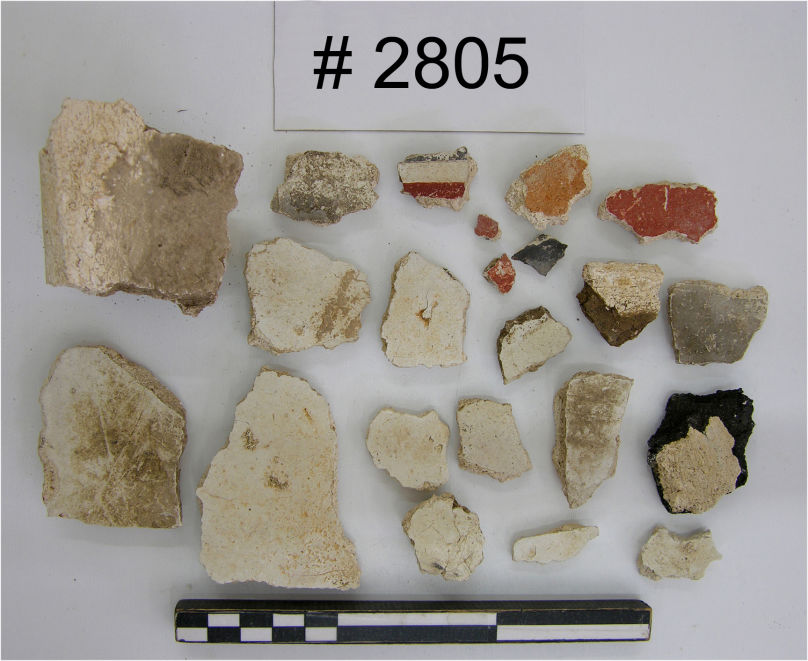
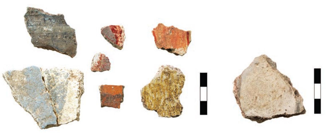
The largest collection of painted plaster fragments was made in 1968 (fig. 6). Smaller collections were made on visits by the author in 1999, 2003, 2010-2013, and consist of small fragments that had been exposed in the meantime, washed out by rainfall. In 2013, these fragments were cleaned in the Wall-Paintings Conservation Laboratory of the Akrotiri Excavation, as part of the systematic storing and evaluating of material from surface collections (fig. 7). The wall-painting fragments from Kokkino Vouno, all of them taken from the slopes of Marinatos’s trench, can be distinguished into the following categories:
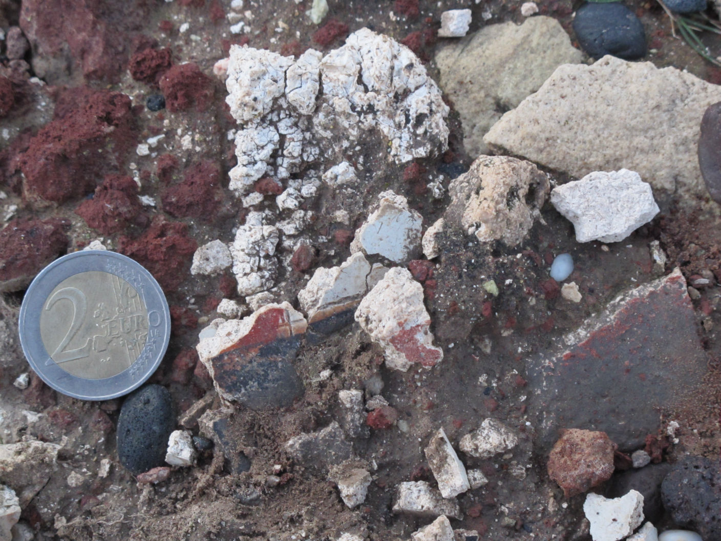
1. Monochrome, red, black, blue or unpainted (white plaster)(fig. 8, fig. 9).
2. Bands, red, black and blue, in contact with unpainted surface or intermediate unpainted (reserved) band, originating from coloured zones which, as was standard practice, were on the upper part of painted walls. These fragments very often preserve fine incisions or impressions of taut twine, which define the thickness of the bands and were guidelines for the rectilinear course of the paintbrush (fig. 8, fig. 9).
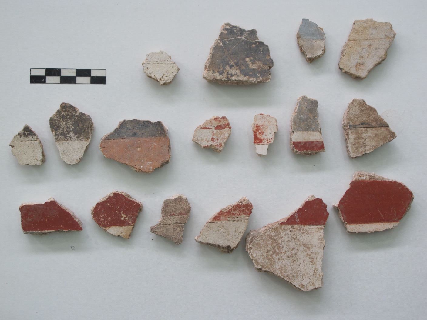
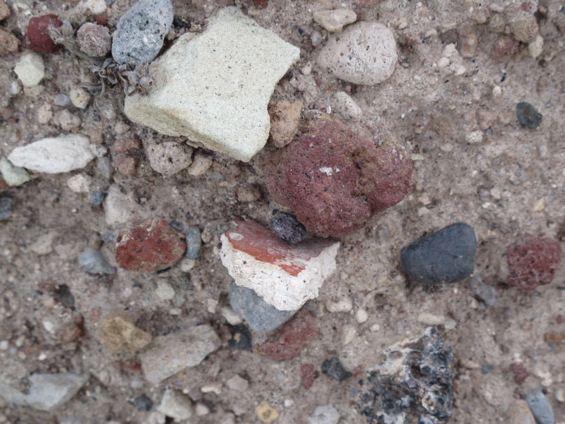
3. Larger fragments from vertical (lateral) edges of wall-paintings, which preserved the turn at the corner of the wall, and smaller ones which preserve the flat edge formed from contact with wood. These are white, black or grey and orange-coloured (fig. 10).
4. One orange-coloured plaster fragment preserves part of a curvilinear edge from the contact of the upper limit of the wall-painting with a beam of the ceiling (fig. 10). Such fragments are rare even from the archaeological site, the biggest examples being from two wall-paintings from Xeste 3, a frieze of orange spirals (ΑΛΣ 7, fig. 24) and the scene of bull-catchers.
5. Fragments preserving a combination of colours or remnants of undecipherable painted motifs. One fragment perhaps comes from grey reeds and a second perhaps from the yellow translucent tassel of a flowering reed (fig. 11).
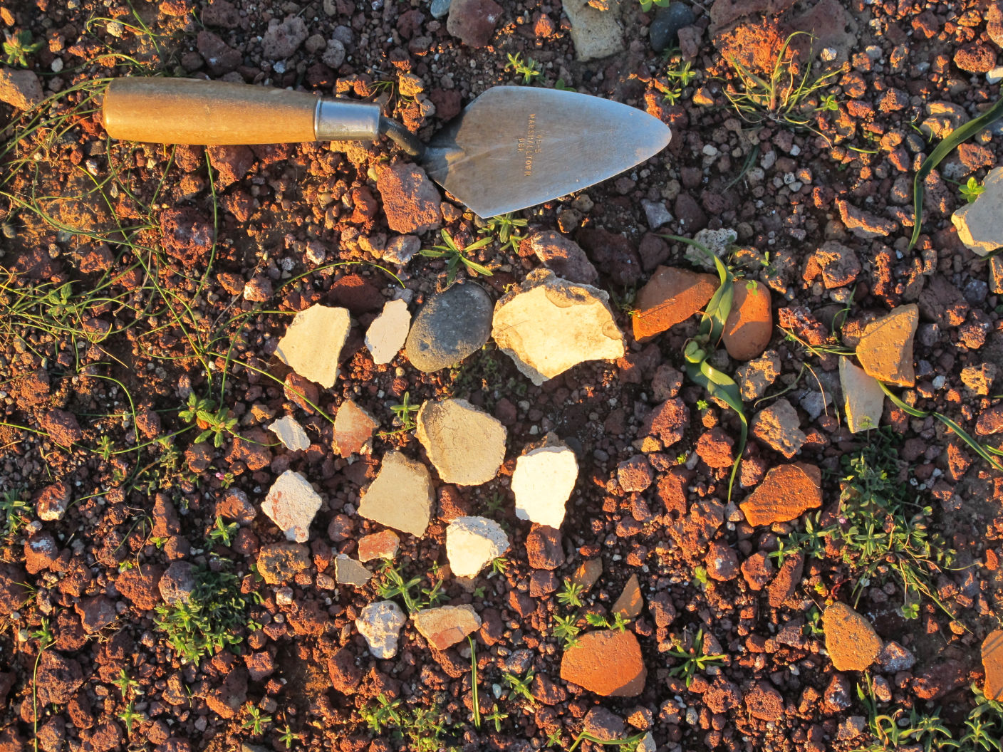
6. Among the fragments found in February 2013, which had been exposed by the winter rains (fig. 12), of particular interest is a badly-eroded fragment (left in situ) with trichrome decoration of vertically intersecting bands, demarcated by deep twine impressions (fig. 13, fig. 14). Upon the wide black band of the lower part (in the image) is a thin ochre band and obliquely upon these begins part of an undecipherable red motif.
These fragments come from several surfaces of wall-painting compositions, as indicated by thethickness, the difference in the treatment of the plaster, the incisions and twine impressions, and the palette of the surviving painted motifs. Moreover, it should be noted that, despite long exposure to the erosive effects of wind (fig 15), water and sun, the quality of most of these murals (with regard to the excellent smoothing of the plaster, the intensity and the homogeneity of the pigments) points to the existence of carefully-constructed buildings on the summit of Kokkino Vouno.
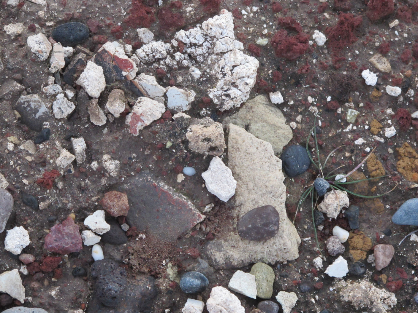
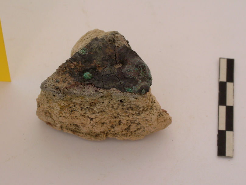
Among the surface finds collected in recent years from the area around Marinatos’s trench, noteworthy is part of a clay semiglobular vessel, inside which are residues of bronze (fig. 16). This is a metallurgical crucible, a not uncommon find in the excavation of the settlement at Akrotiri, but certainly interesting evidence of metallurgical activity in the installations on the neighbouring hill.
The pottery scattered on Kokkino Vouno (much denser in the area of the trench and thinly dispersed at other points of the bluff) is indistinctive, as the sherds are mainly badly eroded and most now have no traces of decoration.
The original depth of Marinatos’s trench is not known, nor is it known whether it reached the rock on which the surrounding buildings were founded. Probably it did not, as no relevant data are noted in the excavator’s detailed daybook. So, if the excavation did not proceed further, it is logical that the wall-painting fragments (excavated and from the surface) are random in terms of colour and give no clue as to the subject of their original surfaces.
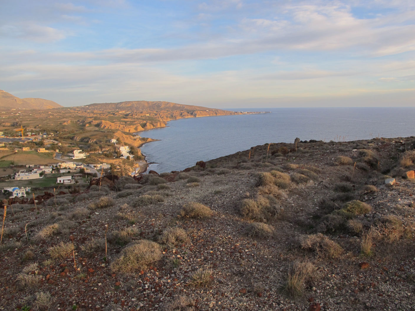
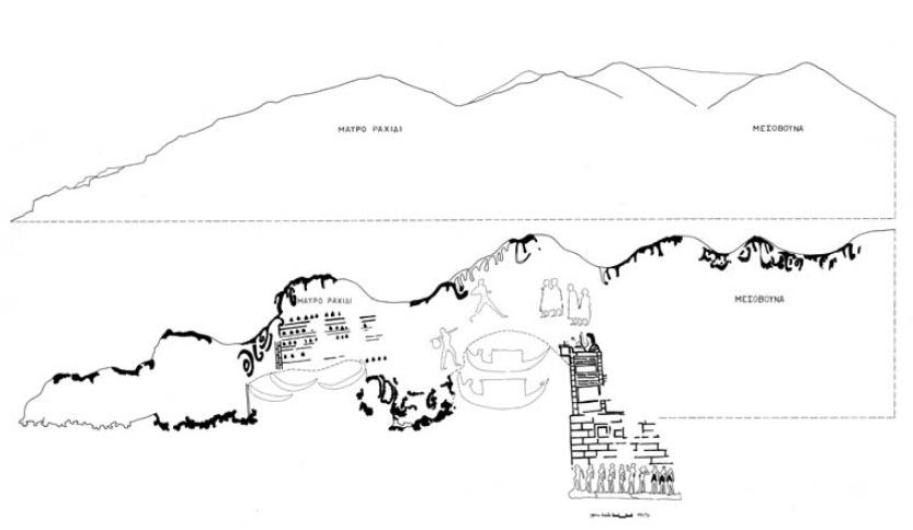
The absence of volcanic ash from the surface and slopes of Kokkino Vouno facilitates diagnostic browsing and archaeological surface surveying on the closest landmark in the environs of the settlement at Akrotiri, which keeps its pre-eruption character. Since the fill immediately south of the excavation and as far as today’s coastline is product of the eruption and the bay-like zone of flat land surrounding Mesovouna and ending at Mavro Rachidi was most probably the natural harbour of the settlement, then it is reasonable to assume that the massive crag of Kokkino Vouno was most probably a spit of land thrusting some way into the sea, thus forming the natural west breakwater. Consequently, this point was of nodal importance for the harbours’ functions, since – its flat ridge in particular – it secured the necessary view towards the southeast coast of the island (fig. 17), the open sea and Crete. We would, therefore, expect there to be at this point something more than a small guardhouse for protecting the settlement; we would expect a developed peri-urban installation for monitoring and controlling the harbour, as well as the settlement’s plain, which would have covered the south shoreline as far as today’s massif of Prophitis Elias.
The city at Akrotiri is confidently identified with the city depicted at the far right part of the South Miniature Frieze, a composition that decorated Room 5 of the West House (fig. 18). In this wall- painting, the city forms a rocky, two-hilled promontory in that part of it overlooking the sea (fig. 19), which C. Doumas identified years ago with the heights of Kokkino Vouno and Mesovouna (fig. 20). Depicted on the second hill in line, to the left of the settlement, is a tripartite(?) building complex (building Κ9 in the graphic reconstruction proposed by Christina Televantou, who has studied the whole composition assiduously), further to the right is part of a large doorway rising from the line of the summit (fig. 19), and below, on the slopes of the headland, stands a broad- fronted oblong building with continuous black triangles in at least five successive rows. The black triangles on this building (Κ8 in Televantou’s numbering, fig. 18), have been considered as rendering traditional island dovecotes (S. Marinatos) or beehives (D. Page), while recently, L. Zorzos argued that they render the triangular dug-out (hyposkapha) man-made caves that exist to this day on the coast, above Mesa Pigadia. This last proposal would lead to the possible identification of the height with Archangelos, where too there are remains of a construction.
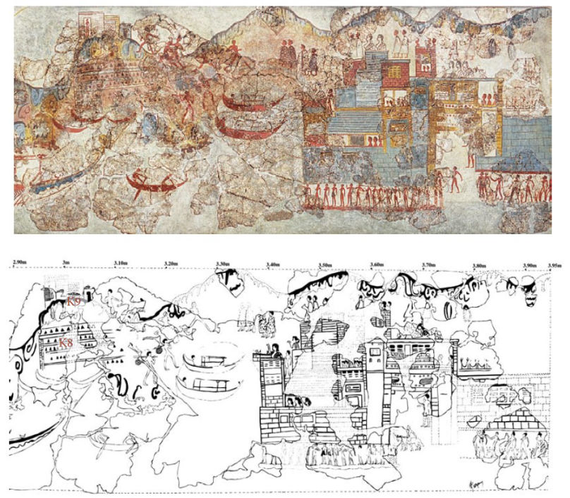
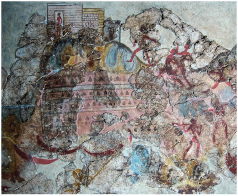
Here, however, it is clear that the sizeable pinkish building is located exactly above the shore, next to the city. This was therefore perhaps a warehouse for goods, with small triangular windows that would have ensured good conditions of illumination and ventilation for keeping the merchandise that was brought to the city’s harbour or loaded on ships there. Another hypothesis pertaining to the singular aspect of this building is that it was a cistern for collecting rainwater, which too would have required multiple openings for ventilation.
The overlying building, which is barely preserved on the wall-painting at this point, had been founded upon the uppermost surface of the second low hill, to the left of the settlement, towards which three runners advance. Visible on the hill are contiguous buildings: the wider first one is bipartite, occupies the greater part of the hilltop and the dense lines on the ‘pillars’ of its fronts perhaps render the isodomic system of ashlar masonry. Depicted in a doorway (?) of the first section, on the brink of the downward slope of the hill, is a male figure turned to the left, as if surveilling the hills or observing the activity taking place at sea. Adjacent, to the right of the building, is an oblong doorway. The building has been interpreted so far as a lookout post, however, its triple façade, its height and its spacious surface, which occupies the upper part of the hill, indicate that it is an important edifice which – if we assume that it can be identified with the remains on Kokkino Vouno – was, furthermore, decorated with wall-paintings.
So, the Miniature Frieze depicts dense building on the hill neighbouring the settlement, but also concentrated human activity, since the buildings are inhabited. Men run towards these from the settlement, either to announce something or (more likely) to have a better view of what significant events were taking place in the harbour and the open sea.
Interesting too in the same wall-painting is the shoreline of the cliff, with a small promontory defining to the right a harbour for large sailing vessels and to the left a cove for smaller boats. If the identifications made are valid, then next to the large harbour (Mavro Rachidi) and to the west of Kokkino Vouno (fig. 21) there was a bay for little ships, probably in the area of today’s Kokkini Paralia. Human figures, shown out of scale with the landscape so as to be distinguished easily by those viewing the frieze from below, run from the city to the hill (above) and carry goods from the harbour to the city (below), indicating a bustling part of the vital zone of economic transactions, rather than an isolated guard-post on the peak. Also at variance with such an interpretation are the massiveness of the buildings and the formal diversity of their façade.
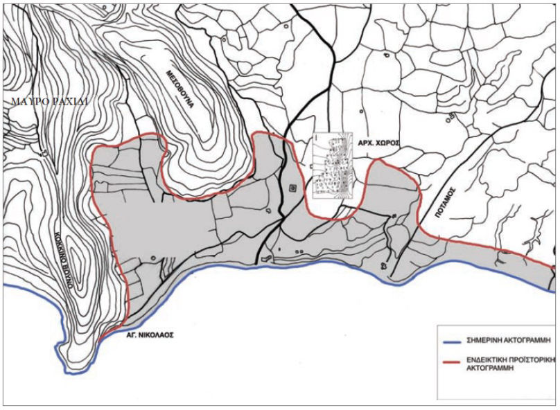
The recent excavations at Akrotiri (1999-2003) yielded evidence that reinforces the data that had earlier led to the identification of city V in the Miniature Frieze with the city at Akrotiri. Furthermore, these excavations confirmed that the settlement had developed along the length of a rocky peninsula thrusting into the sea and forming two bays – one on either side of it – where the city’s two harbours most probably developed (fig. 21). If this is the case, then the second (east) harbour was at the present-day locality of Potamos, but it is not depicted in the wall-painting, which stops exactly with the ‘description’ of the built quay and the multi-storey building that perhaps renders Xeste 4. It is hoped that ongoing geoscopic research in the plain today called Mavro Rachidi, at the foot of Kokkino Vouno (fig. 18), will answer this important topographical question concerning the main (west) harbour, by verifying hypotheses proposed to date.The dispersal of remains on the flat surface of the hill, the identification of some indicative yet significant finds, but mainly the quality of the painted plaster fragments which come from carefully-executed murals that decorated the buildings there, converge on enhancing the important role of the installation on Kokkino Vouno for the flourishing LC I settlement that lay in front of it.
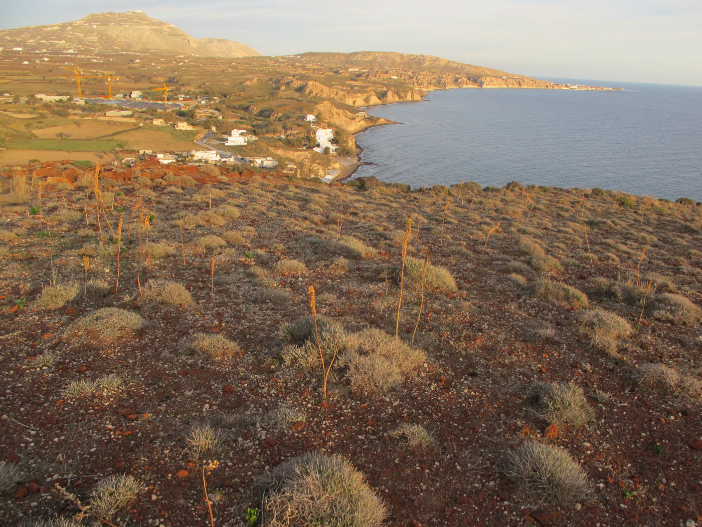
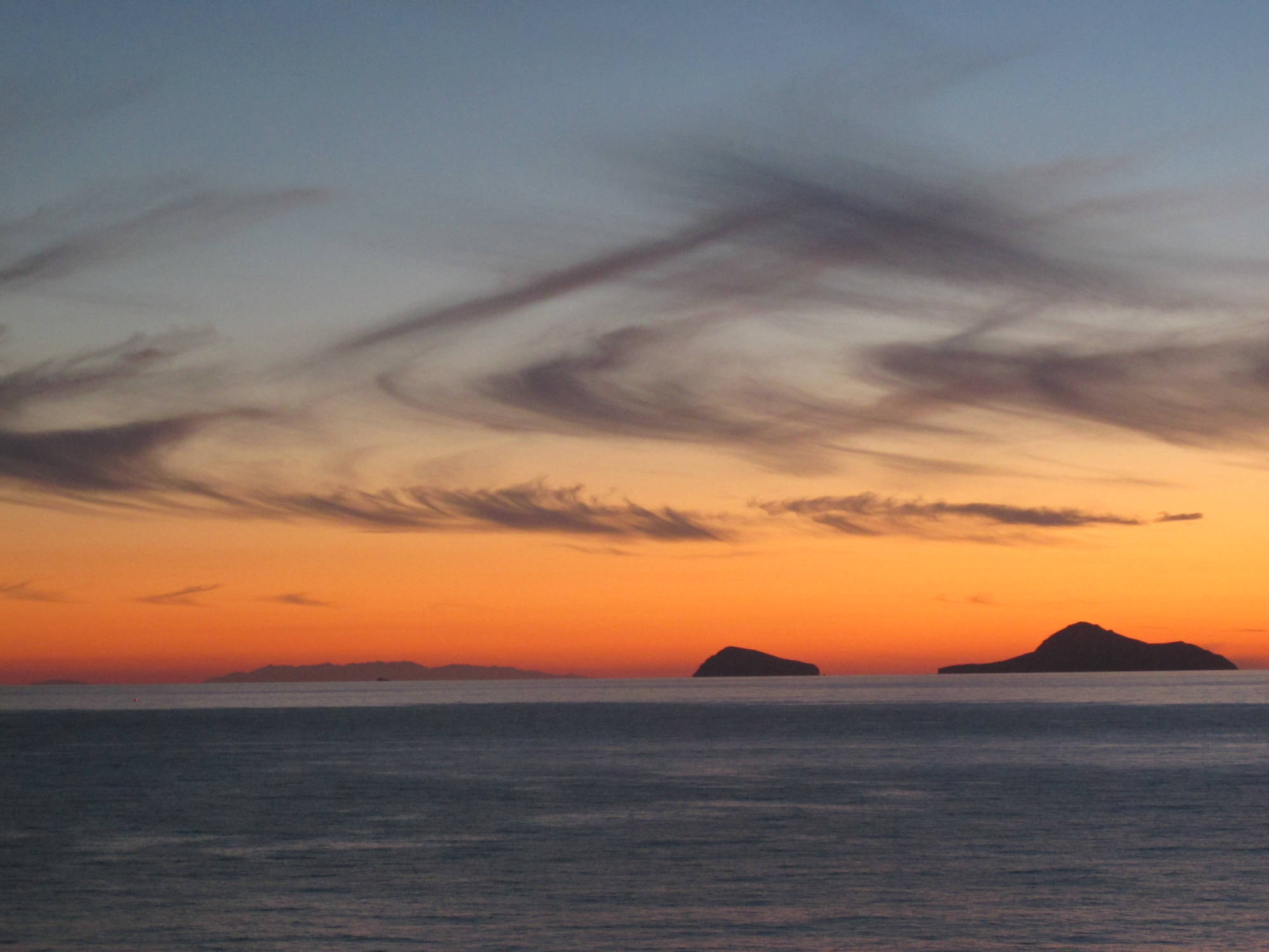
Marinatos’s ‘small dig’, targeted and rewarding his expectations, showed that on the hill of igneous rocks, overlooking the settlement and its busy harbour, there was an installation organically dependent on the urban nucleus at Akrotiri, as is affirmed with meticulous topographical accuracy by the Miniature Frieze from the West House. Indeed, viewers of the wall-painting could turn their gaze from the south wall of the corner of Room 5 and look outside through the large windows at actual Kokkino Vouno, which was depicted next to the painted city. With an analogous movement of the head, whoever stood high up on the rocky hill, with the city to his/her left, gazed out on the Christiana islets, to the southwest, and the blessed land of Crete in the distance (fig. 22), when the horizon was completely clear in the wintry dusk.
Bibliography
C. DOUMAS, Thera: Pompei of the Ancient Aegean, London 1983.
C. DOUMAS, The Wall Paintings of Thera, Athens 1992.
C. DOUMAS, The Early History of the Aegean in the Light of the Recent Finds from Akrotiri, Thera, Athens 2008.
C. DOUMAS, «Searching for the Early Bronze age aegean metallurgist’s Toolkit», στο: P. BETANCOURT – S. FERRENCE (επιμ.), Metallurgy: Understanding How, Learning Why: Studies in Honor of James D. Muhly, Prehistory Monographs 29, 2011, 165-179.
C. DOUMAS, «Le paysage côtier à la région d’akrotiri, Théra, avant l’éruption volcanique du Bronze récent», στο: G. TOUCHAIS, R. LAFFINEUR, F. ROUGEMONT (επιμ.), PHYSIS. L’Environnement Naturel et la Relation Homme-Milieu dansle Monde Égéen Protohistorique, Actes de la 14e Rencontre égéenne internationale, Paris, Institut National d’Histoire de l’Art (INHA), 11-14 décembre 2012, Aegaeum (annales d’archéologie égéenne de l’université de Liège et uT-PasP), 37 (2014), 130-140.
E. HALLAGER, The Master Impression. A Clay Sealing from Greek-Swedish Excavations at Kastelli, Khania, Studies in Mediterranean Archaeology, vol. LXiX, Goeteborg 1985.
Σπ. ΜΑΡΙΝΑΤΟΣ, «Ανασκαφαί Θήρας ΙΙ», ΠΑΕ 1968, 116-117.
Σπ. ΜΑΡΙΝΑΤΟΣ, «Ανασκαφαί Θήρας», Θήρα II, 35-36.
Α. ΜICHAILIDOU, Weight and Value in Pre-Coinage Societies. Vol. ii. Sidelights on Measurement from the Aegean and the Orient, ΜΕΛΕΤΗΜΑΤΑ 61, Athens 2008.
Κ. ΠΑΛΥΒΟΥ, Ακρωτήρι Θήρας. Η οικοδομική τέχνη, Αθήνα 1999.
C. PALYBOU, Akrotiri Thera, An Architecture of Affluence 3,500 years old, Philadelphia 2005.
ΧΡ. ΤΕΛΕΒΑΝΤΟΥ, Οι τοιχογραφίες της Δυτικής Οικίας, Αθήνα 1994.
Α. VLACHOPOULOS, «Detecting ‘mycenaean’ elements in the ‘minoan’ wall-paintings of a ‘Cycladic’ settlement. The wall paintings at akrotiri, Thera within their iconographic koine», στο: H. BRECOULAKI, J. DAVIS, S. STOCKER (επιμ.), Mycenaean Wall-Paintings in Context. New Discoveries and Old Finds Reconsidered, Αθήνα 11-13.2.2011, Αθήνα 2015, 36-65.
Α. VLACHOPOULOS, L. ZORZOS, «Physis and Techne on Thera: reconstructing Bronze Αge environment and land-use based on new evidence from phytoliths and the Αkrotiri wall paintings», στο: G. TOUCHAIS, R. LAFFINEUR, F. ROUGEMONT (επιμ.), Physis. L’environnement naturel et la relation homme-milieu dans le monde Égéen protohistorique, Actes de la 14e Rencontre égéenne internationale, Paris, Institut National d’Histoire de l’Art (INHA), 11-14 décembre 2012, Aegaeum (annales d’archéologie égéenne de l’université de Liège et uT-PasP), 37 (2014), 183-197.
D. PAGE, «The Μiniature Frescoes from Akrotiri, Thera», Πρακτικά της Ακαδημίας Αθηνών 51, Α, 1976, 144.
Αγγ. ΠΑΠΑΔΟΠΟΥΛΟΣ, «Αρχάγγελος. Μία σημαντική θέση στη νοτιοδυτική Θήρα», ΑΛΣ 6, 2008, 89-94